Agriculture - GIS in Ag-Essentials and Applications
In this course you will learn Traditional information in agriculture practices, Understanding of rainfall potential clouds in decision making for irrigation, Water demand assessment and deficit, Sustainable village resources management
ArcGIS Online - Getting Started
Start here if you're new to ArcGIS Online or just need to brush up on your web map skills.

Introduction to QGIS
Learn QGIS 3 for geospatial analysis: create 3D models, analyze terrain, visualize data, and produce maps. Master essential GIS skills for various applications in this comprehensive introduction.
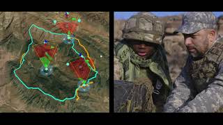
Imagery and Remote Sensing
Learn the basics of observing and understanding our planet with the help of Arc Gis.
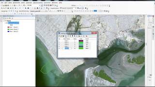
ArcGIS Tutorials for Beginners
This tutorial series will help you through the different tasks of image processing in ArcGis.

Google Earth Pro
Learn to create maps, import shapefiles and coordinates, visualize topography, and convert geospatial data using Google Earth Pro for effective spatial analysis and visualization.

ArcGIS Field Maps
ArcGIS Field Maps allows mobile workers to view their maps in the field, collect data, find assets and track their location on iOS and Android devices.
QGIS for Groundwater Applications
Learn to preprocess and visualize groundwater data using QGIS. Master importing borehole data, interpolating levels, and creating 2D/3D visualizations for hydrogeological studies.
Next Generation Irrigation Management
Explore innovative irrigation techniques using technology and data for precise water management, ensuring optimal crop hydration while conserving resources.

ArcGIS Pro Quick-Start Tutorials
Get started in ArcGIS Pro and begin creating projects, exploring features, analyze spatial data, and edit your maps.
QGIS Tutorial
Learn to pre-process images for NDVI and LULC, create study area maps, and digitize features from Google Earth using QGIS, a powerful open-source GIS software.

Introduction to Geospatial Analysis with Python GeoPandas
Learn to visualize and process geospatial data using Python GeoPandas. Master coordinate conversion, elevation extraction, and geoprocessing techniques for beginners.
GIS & RS
Comprehensive GIS and remote sensing training covering data extraction, analysis, and mapping techniques using ArcGIS and Google Earth for various environmental and spatial applications.
ArcMap Scripting with Python and Arcpy
Master Python and Arcpy for ArcMap: Automate GIS tasks, manipulate data, create custom tools, and process geospatial information efficiently through hands-on scripting exercises.
ArcMap & ArcCatalog
This playlist discusses ArcMap and Geodatabase basics on ArcGis. You will also get to understand the difference between ArcMap and ArcGis Pro, Creating Grid Index in ArcMap, Georeferencing CAD Files in ArcMap and using Layer files in ArcMap and ArcGis Pr…
Working with LIDAR in ArcGIS
Companion Videos for the e-book, "Working with LIDAR in ArcGIS". The eBook is available on Amazon at http://tinyurl.com/hjbujgb for $2.99. These videos cover some of the hands-on exercises from the book as a supplement to the text.
Cartography
Learn techniques for creating diverse maps, from animated routes to historical visualizations, using various tools like Photoshop, QGIS, and Google Sheets. Explore cartography concepts and unique map styles.
ArcGIS Tutorial
Comprehensive ArcGIS tutorial covering various GIS techniques, from basic operations to advanced analyses, including image processing, data extraction, and web mapping.
OSINT at Home - Tutorials on Digital Research, Verification and Open Source Investigations
Learn digital investigation techniques, from image reverse search to geolocation and chronolocation. Develop OSINT skills for verifying social media content and conducting open-source research, applicable to journalism, human rights, and intelligence ana…
ArcGIS Maps for Adobe Creative Cloud
ArcGIS Maps for Adobe® Creative Cloud is ideal for design and communications professionals. These videos will demonstrate how to access data-driven maps inside Adobe® Illustrator and Photoshop and show you how to play with colors and styles to make the e…

ArcGIS Utility Network
Get an overview and an introductory understanding of ArcGIS Utility Network in this series of videos.