New and Old Empires
Explore how geography and historical civilizations shape modern geopolitics through interactive maps and expert insights on shifting alliances, emerging patterns, and global challenges.
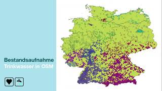
Wo finde ich Wasser? Die kollektive Kartierung von Trinkwasser-Orten in OSM und der Weg dorthin.
Kollektive Kartierung öffentlicher Trinkwasserstellen in OpenStreetMap: Projekt zur Reduzierung von Plastikmüll, Verbesserung der Datenlage und Einbindung von Freiwilligen in Deutschland.
Mit OpenStreetMap die Verkehrswende begleiten – Tagging, Tools und Analysen
Entdecken Sie OpenStreetMap als Werkzeug zur Dokumentation und Analyse der Verkehrswende. Lernen Sie Tagging-Schemata, Erfassungsmethoden und Anwendungsmöglichkeiten für nachhaltige Mobilitätsplanung kennen.
An Endless World Map - Viewing the World Through "Authagraph"
革新的な世界地図「AuthaGraph」の発明:長方形に収まりながら大陸の相対的な大きさを維持。航路、地質学、気象、世界史など多様なテーマに応用可能な新しい世界の見方を提案。
Antarctica Matters
Explore Antarctica's crucial role in Earth's past and future, its impact on global climate, and the unique international scientific cooperation it fosters, as explained by Antarctic researcher Chandrika Nath.
Hastening the Inevitable Demographic Revolution
Explore global population trends, demographic shifts, and their impact on Earth's future. Discover strategies for sustainable population growth and empowering women to shape our planet's destiny.
OpenStreetMap for the Web
Explore OpenStreetMap's rich dataset, APIs for map tiles, search, routing, and location. Learn about storage, searching, and map-making theory for web applications.
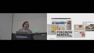
The Geography of Pokémon GO - Beneficial and Problematic Effects on Places and Movement
Exploring Pokémon GO's impact on urban spaces, mobility patterns, and social dynamics through field surveys and geostatistical analysis, revealing geographic biases and safety implications.
Coğrafya Kader Midir?
Ekonomik kalkınma ve büyüme arasındaki farkı, Türkiye'nin yanlışlarını ve insana yatırımın önemini ele alan, ufuk açıcı bir konuşma.
Summiting Dreams - From Mount Everest to the World's Highest Peaks
Inspiring journey of mountaineer Priyanka Mohite, from conquering Everest at 20 to becoming the first Indian woman to climb five 8000m+ peaks. Learn about resilience, teamwork, and overcoming challenges in high-altitude expeditions.
Offensive Cartography
Explore offensive cartography techniques for cybersecurity, including network mapping and vulnerability assessment strategies to enhance penetration testing and security audits.

Integration, Data Sharing, Opensource, and the Agtech Startup Ecosystem
Exploring agtech's potential in Australia: challenges, open data standards, and the importance of interoperability for farmers and developers in the agricultural technology ecosystem.
Making Use of OpenStreetMap Data with Python
Explore OpenStreetMap data manipulation using Python, learning techniques to extract, analyze, and visualize geographic information for various applications.
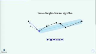
Handling GPS Data with Python
Learn to handle GPS data in Python, from reading/writing tracks to visualizing on OpenStreetMap. Explore libraries, add elevation data, and understand algorithms like Douglas-Peucker and Kalman filters for track simplification and smoothing.
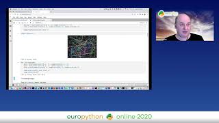
PyRT - Computer Graphics in Jupyter Notebooks for Fun and Teaching
Explore pyRT for raytracing in Jupyter notebooks, creating 2D animations, visualizing algorithms, rendering geodata, and generating 3D graphics with Python.
Cartography - Using Graphs to Improve and Scale Security Decision-Making
Explore Cartography, an open-source tool for visualizing and securing cloud-native assets. Learn how to improve decision-making, track changes, and understand security risks across platforms.

New York - Before the City
Explore Manhattan's pre-colonial ecology through a detailed 3D map, revealing a landscape of hills, rivers, and wildlife where modern New York City now stands.

Three Things to Know Before You Ski to the North Pole
Arctic explorer shares harrowing solo ski trek experiences with engaging anecdotes, stunning visuals, and exclusive footage, offering insights into extreme polar expeditions.
EditBoundary.jl - A Quest to Revive Structured Quad Meshes
Explore algorithms for efficient polygonal approximation in cartography and hydrology, reducing data points while preserving shape for improved visualization and processing in GIS.
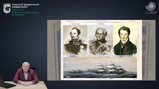
Иван Михайлович Симонов - Первооткрыватель Южного магнитного полюса Земли и 29 островов
Узнайте об Иване Михайловиче Симонове - первооткрывателе Южного магнитного полюса Земли и 29 островов. Исследуйте его вклад в науку и географические открытия.
Cosmic Map Making - Exploring Similarities Between Cosmic and Everyday Maps
Explore cosmic map making's intricacies and surprising similarities to everyday maps with Prof. Adrian Liu, uncovering the Universe's history and the birth of first-generation stars and galaxies.