Supporting Data Journalism Through Compilers for Visual Inputs
Explore innovative compilers for visual inputs in data journalism, focusing on projects that transform data graphics and thematic maps into interactive programs for newsrooms.
Library Map - How Generous Is Your Open Data?
Explore the creation of an interactive Australian public library map, discussing open data accessibility, management, and the process of building interactive maps using public geodata.

Jaguares y Serpientes
Uso de Python y ArcPy para analizar datos de telemetría en la conservación de jaguares, combinando tecnología y ecología para entender y proteger esta especie.
Eroding Coastlines - A Geospatial & Computer Vision Analysis
Explore satellite imagery and Python tools for geospatial analysis to identify and analyze coastal erosion, addressing a critical environmental and humanitarian challenge.
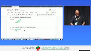
Processing Geodata Using Python and Open Source Modules
Learn to analyze, manipulate, and visualize geospatial data using Python and open-source modules like Shapely, Fiona, rasterio, and GeoPandas. Explore vector and raster data handling, spatial reference systems, and map creation.
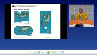
Geospatial Analysis Using Python and JupyterHub
Explore geospatial data processing and visualization using Python, covering vector and raster analysis, deep learning applications, and high-performance computing techniques for efficient spatial data handling.
Predicting Urban Heat Islands in Calgary
Learn to predict urban heat islands using satellite imagery and geospatial Python libraries. Explore spatial regression methods, data processing, and visualization techniques for sustainable urban planning.
Saving Lives with Predictive Geo - AI
Explore geospatial Python libraries for Multi-Criteria Decision making, including imagery dataset processing, overlay analysis, and zonal statistics. Learn to create intuitive geo-visualization portals using vector tiles.

LITMUS - 위치 지능화 데이터 분석 및 교통 패턴 시스템
Discover how SK Telecom's LITMUS system analyzes mobility patterns through AI, providing detailed insights into transportation habits, commuting behaviors, and traffic patterns for solving urban challenges.
Neuro-Symbolic AI with AllegroGraph
Explore Neuro-Symbolic AI's fusion of neural networks and symbolic AI. Learn how AllegroGraph's Knowledge Graph Platform enables complex reasoning and data integration for advanced AI applications.
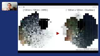
An Inside Look at NASA's SpaceML Worldview Search
Explore NASA's SpaceML Worldview Search with insights from Machine Learning Lead Anirudh Koul, covering innovative applications in space exploration and data analysis.

Auto Arborist - Towards Mapping Urban Forests Across North America
Explore innovative techniques for mapping urban forests across North America using advanced data assimilation and machine learning methods.

Graph Representation Learning for Street Networks
Explore graph representation learning techniques for analyzing and understanding complex street network structures.
Leveraging Databricks for Advanced Geospatial Analysis
Explore advanced geospatial analysis using Databricks. Learn to process spatial data at scale, integrate GIS with big data analytics, and utilize the H3 index for efficient grid-based operations.

Data Science for Social Good - Predicting Air Pollution in a Post-COVID World
Explore a data science project with UNICEF to model post-pandemic global air pollution and map child exposure to harmful pollutants, featuring insights from volunteer data scientists.
Transforming Transport Data by Integrating Spatial and Aspatial Data
Revolutionizing transport data management through spatial and aspatial data integration, enhancing modal usage, asset management, road safety, and public transport for improved community outcomes.
How McDonald's Uses Machine Learning to Optimize Restaurant Site Selection
Explore ML techniques for optimizing restaurant site selection, leveraging Databricks Platform to enhance global decision-making for McDonald's expansion strategy and drive business outcomes.
Live Coding: Avoiding Traffic with Wolfram Language
Explore real-time problem-solving using Wolfram Language to avoid London's morning rush hour traffic through API calls, machine learning, image processing, and graph theory.
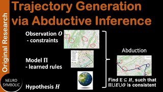
Trajectory Generation via Abductive Inference
Discover how abductive inference enables efficient geospatial trajectory generation through innovative logical programming and deep learning approaches for AI advancement.
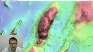
ProRaster Scientific 2.5.01 - Deep Dive into Contouring Features
Master the contouring features in ProRaster Scientific 2.5.01, from basic layer creation to advanced techniques like manual contours, opacity settings, and custom labeling for enhanced geospatial visualization.

I know what you grew last summer | Steve Shirtliffe | TEDxUniversityofSaskatchewan
What if satellites could help farmers plan smarter for the next season? Drawing from his roots on a Prairie farm and his career pioneering agriculture research, this talk explores how drones, satellite imagery and AI unlock new ways to manage crops and land. But how do we harness big data in digital