NOAA Scientific Integrity Policy - Press Availability at AGU Fall Meeting 2011
NOAA's Scientific Integrity Policy explained: impacts on operations, extreme weather analysis, and scientific practices. Insights into policy implementation and its significance for climate research.
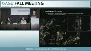
Earth at Night - New Satellite Imagery Reveals Detailed Global View
Unveiling a groundbreaking cloud-free view of Earth at night, revealing new insights into human activity, natural phenomena, and global patterns through advanced satellite imagery and scientific analysis.
NOAA's Scientific Integrity Policy - Unveiling and Discussion
Unveiling of NOAA's scientific integrity policy, emphasizing protection of scientific findings, transparency, and strengthening science. Follows a lecture on predicting and managing extreme events.
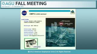
Space-Based Operational Global Earth Observations From NPP and JPSS - 2012
Explore operational applications and initial results from Suomi NPP and JPSS satellites, including sensor performance, data products, and their impact on global Earth observations and weather forecasting.
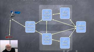
Robots and Oceans: Deep Sea Robotics with Liquid Robotics
Explore deep sea robotics with Java pioneer James Gosling, discussing Liquid Robotics' innovative ocean-monitoring technology, its applications, and network architecture.
Data Assimilation - Kalman Filter - Lecture 7
Explore Kalman Filter in data assimilation for weather and climate models. Learn theoretical foundations and practical applications of this crucial mathematical approach.
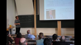
The Legacy of Rudolph Kalman - Systematic Approaches to Data-Driven Predictive Modeling
Explore Rudolph Kalman's groundbreaking work on data-driven mathematical modeling and its impact on fields like space control, weather prediction, and AI. Gain insights into optimization and iteration concepts.
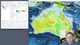
GEBCO 2023 Gridded Bathymetry Data Processing in ProRaster Scientific
Explore GEBCO 2023 bathymetry data using ProRaster Scientific. Learn to create raster sources, join operations, and export to MRR format. Visualize sea level changes and paleo-topography.
Visualization with Python Tutorial
Learn Python visualization techniques for geophysical fluid dynamics, covering data representation and analysis tools essential for atmospheric and oceanic research.
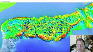
Exploring the Gulf of Mexico Bathymetry - Seabed Features and Geological Phenomena
Explore Gulf of Mexico's underwater topography through high-resolution bathymetry data. Discover unique seafloor features, analyze salt diapirism, and visualize sea level changes using advanced geospatial tools.

Theoretical and Practical Perspectives in Geophysical Fluid Dynamics - Afternoon Session
Explore geophysical fluid dynamics through lectures, talks, and tutorials on eddies, waves, turbulence, and climate modeling. Gain insights from theory, models, and observations in this interdisciplinary meeting.
Bayesian Inference - Lecture 2
Explore Bayesian inference principles, methods, and applications in data assimilation for weather and climate modeling. Gain insights into uncertainty estimation and practical implementation.
Nonlinear Dynamics Insights into Golden Tides in the Caribbean Sea
Explore nonlinear dynamics of Sargassum transport in the Caribbean Sea, examining mesoscale eddies as carriers and mechanisms of coastal inundation using satellite data and minimal models.
Finite Difference Schemes for Partial Differential Equations in Oceanography - Munk Equation and Shallow Water Equations
Explore high-order finite difference schemes for Munk equation and Shallow Water equations on Cubed Sphere grid, with numerical and convergence analysis.
Oceans in a Warming Climate - Understanding Sea Level Rise and Climate Projections
Explore ocean physics in climate change, focusing on sea level patterns and improving climate simulations through machine learning and physics integration for more accurate projections.

Sea Level Rise Can No Longer Be Stopped, What Next? - With John Englander
Oceanographer John Englander explores the inevitable rise in sea levels, its profound impacts, and the urgent need for intelligent adaptation strategies in coastal communities worldwide.
Can Scientists Save Our Earth? - Earth's Survival - Earth Stories
Explore Earth's critical environmental challenges and potential solutions in this visually stunning documentary, featuring insights from leading climate scientists across global ecosystems.
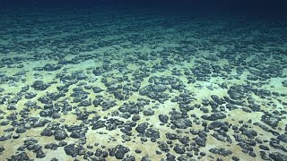
Oceanography - Marine Sediments
Explore marine sediment types, their formation, distribution, and significance in oceanography. Learn about lithogenous, biogenous, hydrogenous, and cosmogenous sediments and their impact on ocean ecosystems.
Geology - The Ocean Floor
Explore ocean floor features like abyssal plains, mid-ocean ridges, and continental shelves. Learn about seafloor geology, oceanic crust formation, and plate tectonics in this comprehensive lecture.
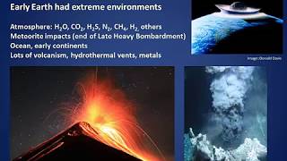
How Did Life First Find a Way? A Review of the Scientific Evidence
Explore scientific evidence on life's origins, from early Earth to modern microbial communities. Covers key concepts like phototrophy, ATP synthesis, and the impact of extreme environments on evolution.

Earth Science - Introduction to Earth Science
Comprehensive introduction to Earth Science, covering geology, oceanography, meteorology, and astronomy. Explores Earth's formation, systems, scientific methods, and the universe's scale and history.