Using Technology to Mitigate the Dangers of Airborne Volcanic Ash
Explore volcanic ash hazards and mitigation strategies using Earth science data and technology. Learn about volcano types, eruption indicators, and advanced modeling techniques for ash cloud prediction.
The Importance of Studying Clouds - NASA Cloud Science and Classroom Inquiry
Explore cloud science with NASA experts, covering topics like the water cycle, phase changes, and radiant energy. Engage in hands-on activities and learn to use NASA data for classroom projects.
The Climate Canary: Measuring Change on Antarctica's Pine Island Glacier
Explore Antarctica's Pine Island Glacier, its role as a climate indicator, and methods for measuring glacial change. Learn about ice dynamics, mass balance, and global implications through expert insights and hands-on activities.
Using Scientific Field Campaigns to Learn About Climate Science
Explore climate science through scientific field campaigns. Analyze atmospheric data, understand climate models, and engage in hands-on activities to enhance understanding of Earth's climate system.

Weather's Influence on Earthquakes - Press Conference
Explore the intriguing connection between weather patterns and seismic activity, featuring insights from experts on monsoons, icecap retreat, and their potential impact on earthquake occurrence.
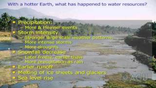
Climate Change: What's Going On and How Will It Affect Us
Explore the science behind climate change, its impacts on Earth systems, and potential future scenarios. Learn about evidence, models, and strategies for addressing this global challenge.
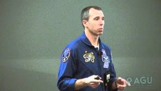
Adventures of a Geoscientist Astronaut - Nuts, Bolts, and Repairs in Earth Orbit
Geophysicist astronaut shares experiences from two space missions, including Hubble telescope repair and International Space Station assembly, offering unique insights into space exploration.
Recent Advances in Lunar Science - Results from NASA's Lunar Orbiter and India's Chandrayaan-1
Explore latest lunar discoveries from NASA and India's Chandrayaan-1 mission, presented by NASA scientist Noah Petro, offering insights into recent Moon studies and space exploration advancements.
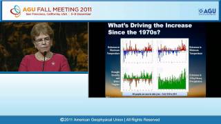
Predicting and Managing Extreme Weather and Climate Events - Fall 2011
Explore extreme weather prediction and management with NOAA's Jane Lubchenco. Learn about challenges in forecasting, monitoring, and mitigating impacts of various environmental events to enhance community resilience.
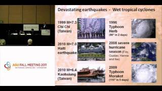
Weather's Influence on Earthquakes and Volcanoes
Exploring connections between weather patterns and seismic/volcanic activity, revealing how surface phenomena can influence underground events and potentially impact eruption timing.
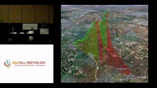
Innovations for Understanding Weather and Climate
New tools for weather and climate monitoring: mobile alerts for severe weather, advanced cloud radar systems, and high-altitude atmospheric gas sampling techniques to enhance forecasting and climate research.
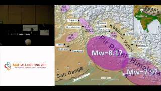
Is a Megaquake Brewing in the High Himalaya? - AGU Fall Meeting 2011 Press Conference
Researchers discuss potential for magnitude 9 earthquake in Kashmir Valley, using GPS monitoring and historical evidence to assess seismic risk in the densely populated Himalayan region.
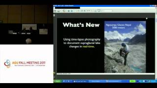
Mountain Glaciers - Dramatic Changes Caught on Film
Time-lapse photography reveals rapid changes in Nepalese glacier lakes, while studies show peak water reached for Western Hemisphere glaciers and concerning predictions for Canadian glaciers.
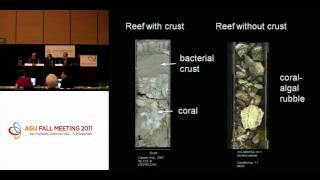
Ocean Acidification Impact on Coral Reefs - Press Conference
Experts discuss ocean acidification's impact on coral reefs, examining natural occurrences, lab simulations, and historical data to understand mechanisms and ecosystem vulnerability.

The Great Mississippi Flood of 2011 - Scientific Findings and Impacts
Explore the impacts of the 2011 Mississippi River flood on sediment distribution and ecosystem restoration efforts, with insights from researchers tracking nutrient movements and assessing restoration strategies.
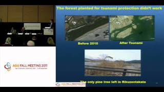
The 11 March 2011 Japan Tsunami - New Insights and Impacts - Press Conference
Insights from the 2011 Japan tsunami: wave behavior, coastal impacts, and global effects. Scientists discuss new findings on tsunami dynamics, damage patterns, and ecological consequences.
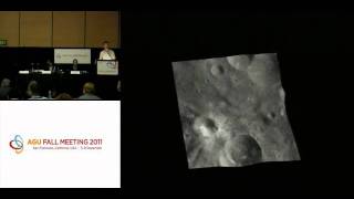
Dawn's New View of Asteroid Vesta - Geologic Maps and Surface Features
NASA's Dawn mission unveils groundbreaking geologic maps of asteroid Vesta, revealing diverse surface features, north-south dichotomy, and insights into its composition, history, and relationship to meteorites.
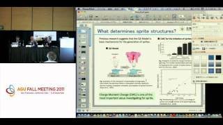
Sprites and Elves: 3D Observations of Upper Atmospheric Lightning Phenomena
Groundbreaking 3D observations of sprites and elves, mysterious luminous events in the upper atmosphere, reveal new insights into their formation and characteristics.
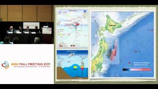
The 11 March 2011 Japan Tsunami - Scientific Assessments and Implications - Press Conference 1
Scientists discuss tsunami forecasting, eyewitness video analysis, and risk awareness implications following the 2011 Japan tsunami. Experts explore lessons for future preparedness and Pacific Northwest seismic risks.
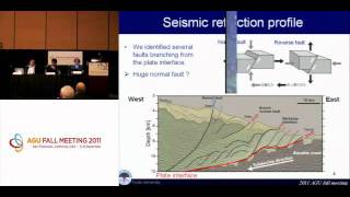
New Views of Japan's 11 March 2011 Tohoku Megaquake
Researchers reveal significant sea-floor changes and unique aspects of the 2011 Tohoku megaquake through submersible dives and seismic imaging, offering new insights into its dual nature and underlying geological factors.
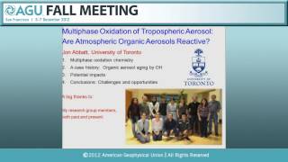
New Atmospheric Sciences Fellows Presentations - Fall Meeting 2012
Presentations by new Atmospheric Sciences Fellows covering topics like cumulus convection modeling, organic nitrates, aerosol oxidation, and extreme convective storms using satellite data.