Hardware Selection and Trends in Hydraulic Modelling
Explore hardware trends in hydraulic modeling, focusing on GPU capabilities, parallel computation, and their impact on solution schemes. Learn to adapt to new technologies for improved efficiency and accuracy.
130 Years of Natural & Anthropogenic Modifications of the Venice Lagoon - Evolution of Tidal Meanders
Explores tidal meander evolution in Venice Lagoon over 130 years, examining hydrodynamic changes, morphology, and sediment transport using diverse data and modeling techniques.
Submarine-Channel Meandering and Salt-Basin Filling
Explore submarine channel evolution and salt basin filling through 3D seismic data analysis, comparing underwater patterns to river meandering and examining the impact of salt domes on channel migration.
Where and Why Do Submarine Canyons Develop?
Explore the global distribution and development of submarine canyons, their role in sediment transport, and factors influencing their connection to terrestrial sources using Bayesian regression and spatial analysis.
Gate & IES Preparation
Comprehensive preparation for GATE and IES exams in various engineering disciplines, covering key topics and featuring expert interviews and exam strategies.
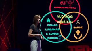
Nós, Mudanças Climáticas e Impactos - Responsabilidade e Enfrentamento
Exploração dos diversos impactos das mudanças climáticas em nossas vidas e a responsabilidade coletiva em enfrentar desafios ambientais atuais e futuros.
Comment régénérer le cycle de l'eau
Découvrez les impacts de nos modes de vie sur le cycle de l'eau et les solutions pour le régénérer, présentés par une ingénieure hydrologue engagée dans la restauration de cette ressource vitale.
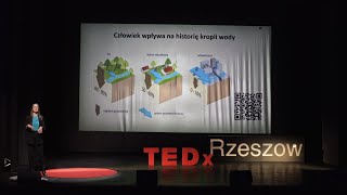
Zdrowe rzeki receptą na walkę z powodziami i suszami
Znaczenie zdrowych systemów rzecznych w walce ze zmianami klimatu i ich wpływ na codzienne życie. Ekspertka wyjaśnia, jak poprawić kondycję rzek dla lepszego klimatu i środowiska.

The Governance of Water in a Changing World - Venice's Climate Crisis Challenge
Venezia come esempio di fragilità minacciata dalla crisi climatica. Strategie di lungo termine per il governo dell'acqua in un mondo che cambia, presentate da un esperto di fama mondiale.

The Governance of Water in a Changing World - Venice's Climate Crisis Challenge
Analisi della fragilità di Venezia di fronte alla crisi climatica, evidenziando la necessità di strategie a lungo termine per la gestione delle risorse idriche in un mondo in cambiamento.
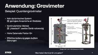
Quantum Sensing for Earth Observation - What Have Atoms Ever Done for Us?
Einblick in Quantensensorik für Erdbeobachtung: Atominterferometrie zur Schwerefeldmessung, aktuelle Entwicklungen und Anwendungen in Geodäsie, Geophysik und Hydrologie.
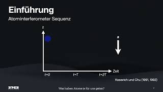
What Have Atoms Ever Done for Us? - Quantum Sensing in Earth Observation
Entdecken Sie die faszinierende Welt der Quantensensorik und ihre Anwendungen in der Erdbeobachtung. Erfahren Sie, wie fallende Atome und Laser zur präzisen Messung des Erdschwerefelds eingesetzt werden.
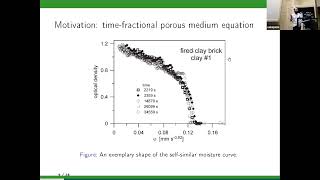
Numerical Methods for Nonlocal and Nonlinear Parabolic Equations with Applications in Hydrology and Climatology
Odkryj metody numeryczne dla nieliniowych równań parabolicznych i ich zastosowania w hydrologii i klimatologii.
QGIS Essentials for Water Modelling
Learn essential QGIS tools for water modelling, including PCRaster plugin, flow direction styling, and catchment map creation. Gain practical skills through live demonstrations and expert insights.
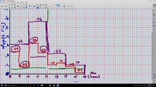
Rainfall Characteristics - Intensity, Frequency, and Terminology
Explore rainfall characteristics including intensity, frequency, and terminology in this comprehensive video for engineering and computer science students.
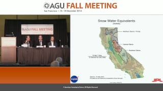
California's Epic Drought as Viewed from Space - Fall 2014
Explore California's severe drought through space-based observations, examining water storage, groundwater depletion, and snowpack changes using advanced geodetic sensors and satellite data.
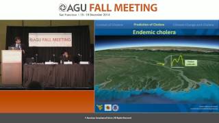
Climate Change and Cholera: Seasonal Patterns and Global Impact
Explore the impact of climate change on cholera outbreaks, examining case studies from Mozambique, South Sudan, and Haiti to understand seasonal patterns and predict future trends.
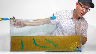
How French Drains Work
Explore subsurface drainage systems, their mechanics, and applications in protecting structures and managing water flow. Learn about the principles behind French drains and their effectiveness.
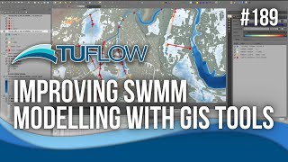
Improving SWMM Modeling with GIS Tools
Enhance stormwater management with EPA SWMM: Learn its history, use TUFLOW QGIS plugin for efficient data creation, and discover advanced features for streamlined workflows and improved project outcomes.
Hydrologic Applications with InfraWorks and InfoWorks ICM
Explore advanced hydrologic workflows using InfraWorks' automatic catchment generation tools to accurately size critical infrastructure in InfoWorks ICM for dams, bridges, and culverts.
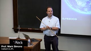
NISAR: The Next Phase in Remote Sensing of the Earth
Explore NISAR satellite mission's advanced Earth remote sensing capabilities, focusing on solid Earth science, hydrology, and disaster assessment with Prof. Mark Simons.