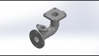
Pipe with Flanges CAD Modeling Tutorial - SolidWorks
Learn to model a pipe with flanges in SolidWorks, mastering essential CAD techniques for mechanical engineering and product design.
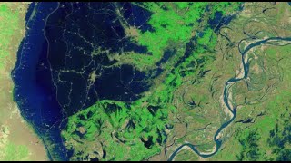
Mapping the 2022 Indus Valley Flood Using ProRaster Scientific - Pakistan
Map the 2022 Indus Valley Flood using ProRaster Scientific. Learn to process satellite imagery, create custom water indices, and integrate multi-temporal data for comprehensive flood extent analysis.
NDVI Analysis and Biomass Proxy Calculation for Coorabulka Station Using ProRaster Scientific
Perform real-time vegetation change analysis using ProRaster Scientific 2.2.03. Process Landsat imagery, compute NDVI, transform data, and visualize results for Coorabulka Station over 10 years.
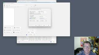
Create Product Sequence Wizard in ProRaster Scientific 2.2 - Tutorial
Turbocharge productivity with the new "Create Product Sequence" wizard in ProRaster Scientific 2.2. Easily create and edit multispectral satellite imagery product sequences, eliminating time-consuming individual product creation.
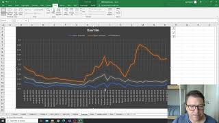
NDVI Analysis for Vegetation Change at Coorabulka Station - Part 6
Analyze temporal vegetation statistics using Excel, interpret graphs, and create a biomass proxy measure for Coorabulka Station's carrying capacity assessment.
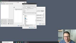
NDVI Analysis and Product Processing in ProRaster Scientific - Part 4
Aprenda a construir cascatas de processamento de produtos para calcular NDVI, recortar polígonos e computar estatísticas temporais usando ProRaster Scientific para análise de vegetação.
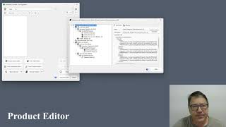
The Multispectral Product Editor in ProRaster Scientific - Tutorial
Explore virtual processing cascades for multispectral satellite imagery using ProRaster Scientific's product editor. Master operations, execution control, and advanced features for efficient data analysis.
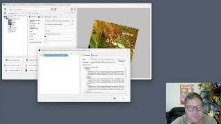
Wooroloo Fire Scar Analysis Using ProRaster Scientific
Analyze Wooroloo fire scar using Landsat data, ProRaster Scientific software, and advanced geospatial techniques. Learn to create scene sequences, compute indices, and generate statistics.
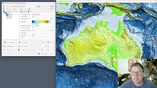
GEBCO 2023 Gridded Bathymetry Data Processing in ProRaster Scientific
Explore GEBCO 2023 bathymetry data using ProRaster Scientific. Learn to create raster sources, join operations, and export to MRR format. Visualize sea level changes and paleo-topography.
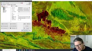
Tjoritja Fire Scar Analysis Using ProRaster Scientific
Analyze Tjoritja fire scar using Landsat imagery and ProRaster Scientific. Learn to build branched processing chains, compare indices, and create final map renderings.
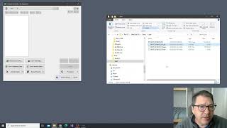
Working with Spot7 Multispectral Satellite Data in ProRaster Scientific
Manually import and analyze Spot7 multispectral satellite data in ProRaster Scientific for vegetation studies using high-resolution spectral bands and NDVI rendering techniques.
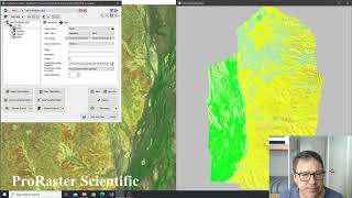
Building Advanced Collated Mosaic Sequences for NDVI Analysis - Part 3
Explore advanced Collated Mosaic Sequence creation in ProRaster Scientific for enhanced temporal vegetation analysis of Coorabulka Station using Landsat imagery and NDVI calculations.
Building Mosaics and Collated Mosaic Sequences for NDVI Analysis - Part 2
Aprenda a criar mosaicos e sequências de mosaicos colados usando ProRaster Scientific para análise de vegetação em Coorabulka Station, Queensland, ao longo de um ano.
NDVI Analysis Using ProRaster Scientific - Coorabulka Station Case Study - Part 1
Explore vegetation change analysis using ProRaster Scientific, focusing on Coorabulka Station. Learn to build Landsat scene databases, create mosaics, and compute NDVI for comprehensive environmental monitoring.
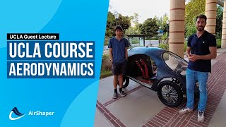
Shell Eco Marathon - Aerodynamics Course
Explore aerodynamics fundamentals, CFD basics, and wind tunnel principles. Gain insights into UCLA's eco marathon design for optimizing vehicle efficiency and performance.
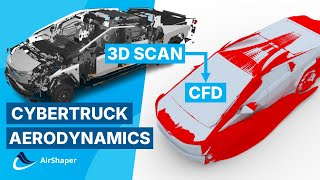
Tesla Cybertruck Aerodynamics - Exclusive 3D Scan Reveals Flow Secrets Through CFD Simulation
Explore Tesla Cybertruck's aerodynamics through exclusive 3D scan and CFD simulation. Analyze design features, flow patterns, and drag coefficient to understand its impressive aerodynamic performance.
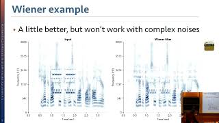
New Twists for New Tricks - Making Audio Deep Learning Practical
Explore innovative approaches to audio deep learning, addressing practical challenges in efficiency, unsupervised learning, and resource-limited scenarios for enhanced audio processing and source separation.
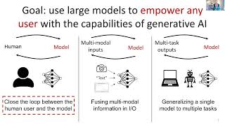
Foundational Models for Robotics: Removing the Engineer from the Loop
Explore foundational models in robotics, empowering users with AI capabilities and revolutionizing human-computer interfaces through autonomous systems and multi-modal properties.
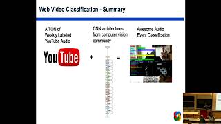
Recognizing Sound Events - 2019
Explore deep neural networks for sound classification, covering speech, music, and environmental sounds. Learn about AudioSet ontology and applications in bioacoustics and cross-modal learning.
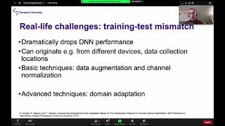
Computational Analysis of Sound Scenes - 2020
Explore computational sound scene analysis, covering tasks from basic classification to advanced localization and captioning, with deep learning techniques and data requirements.
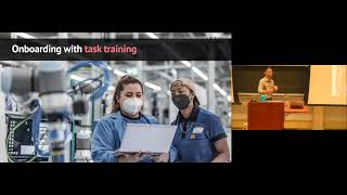
Becoming Teammates: Designing Assistive, Collaborative Machines
Explore the design of intelligent machines for human-machine teamwork, focusing on onboarding, error management, and ad hoc collaboration, with applications in supporting older adults aging in place.