Description:
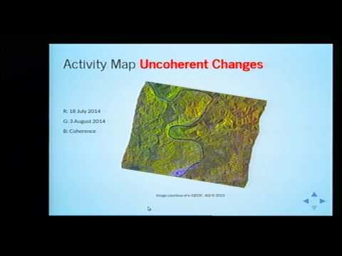
Discover how Python can aid in mine clearance efforts through advanced satellite image processing in this EuroPython 2015 conference talk. Learn to generate Activity Maps using space-borne radar Earth images and thematic data, employing numpy, scipy, and gdal libraries. Follow along as the speaker demonstrates the process using IPython Notebook, showcasing how this technology can help classify dangerous zones and safer areas in minefields. Gain insights into how this innovative approach could potentially reduce time spent on field surveys for removing UneXploded Ordnance (UXO), making post-conflict cleanup operations more efficient and cost-effective.
Activity Map from Space - Supporting Mine Clearance with Python
Add to list