Description:
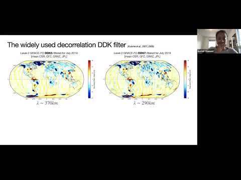
Explore the geodetic signature of continental hydrology in this AGU Geodesy Section webinar featuring Kristel Chanard from Université de Paris - IPG. Delve into what geodesy can reveal about the water cycle, examining the Gravity Recovery And Climate Experiment (GRACE) and Follow-On missions. Learn about advanced techniques for filtering GRACE data, including observational gap filling with M-SSA and spatial filtering. Validate these methods through comparisons with SLR gravity coefficients and regional hydrological mass balance. Investigate hydrology and deformation in aquifer regions, focusing on the Ozark Aquifer system as a case study. Analyze groundwater wells, GRACE-derived loading models, and GNSS data to extract and model poroelastic signals, ultimately estimating surficial elastic parameters.
Geodetic Signature of Continental Hydrology
Add to list